gordon.dewis.ca - Random musings from Gordon

Subscribe

Archive for July 23rd, 2012

Storm damage at Golden Lake

July 23, 2012 @ 23:19 By: gordon Category: Cottage, Photography, Weather

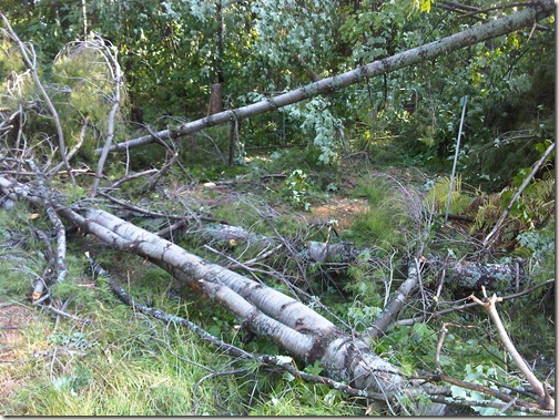
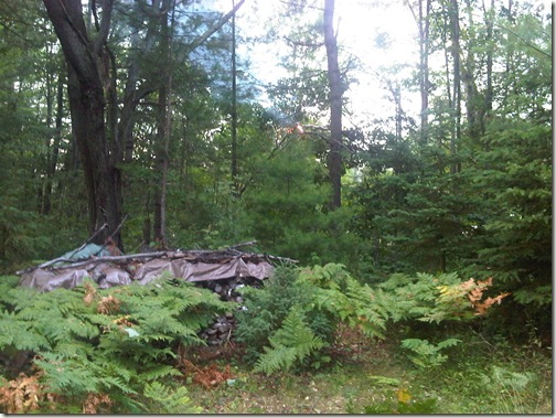
My parents sent me a few pictures of the damage around the cottage up at Golden Lake. Fortunately, our cottage was fine, but our neighbours’ properties have a lot of downed trees. Apparently, the neighbours saw a waterspout on the other side of the lake and there are unconfirmed reports of a tornado touching down in the area.

These are on our neighbour’s property:
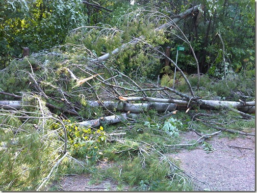
IMG00179-20120723-1658

IMG00181-20120723-1659

Some poor U-Haul trailers at the storage place across the highway:
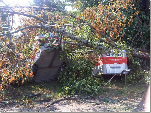
IMG00184-20120723-1703

If you look closely, you’ll be able to make out the branches caught on the power lines that caught fire when the power was restored. A few seconds after my mom took this picture the line breaker on one of the poles blew with an impressive “bang!”. The firemen then put the flames out and stuck around to make sure that the fire didn’t flare up again.

IMG00186-20120723-2021

A tip o’ the hat to my mom who took these photos.

An exciting afternoon indeed

July 23, 2012 @ 15:31 By: gordon Category: Weather

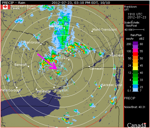
I’ve been keeping an eye on the Franktown radar this afternoon. The storm that has been making its way down the Ottawa Valley has been tracking in the direction of the magenta arrow in this image:

If you’re in the path of the storm, you should probably take cover. Environment Canada has issued a number of tornado warnings for places in Eastern Ontario this afternoon.

My parents are at the cottage on Golden Lake (the lake immediately above the tail of the arrow) and they told me that they’ve never seen a storm like this one. Lots of trees and branches are down, the power’s out and so are the land lines. And apparently they can see “round 2” approaching. They’re in one of the places where a tornado warning has been issued, so hopefully they’re be ok!

Exciting weather this afternoon

July 23, 2012 @ 13:16 By: gordon Category: Weather

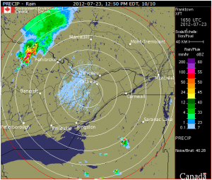
It’s shaping up to be an interesting afternoon weather-wise. I took a look at the Franktown radar a few minutes ago and saw a large purple blog making its way towards Ottawa. The snapshot to the right is the most recent radar image (as of about 12:55) and the purple blob has spread out a bit and become a red and yellow blog that covers a slightly larger area. The track of the incoming weather suggests that the strongest part of the storm is going to pass just to the south of Ottawa, but that could change, of course, or the rain north of the blob could pick up some energy and develop into more exciting weather.

Looking at the weather trends for the last 24 hours, you can see the pressure had dropped since noon yesterday:

The aviation forecast suggests that we’ll see thunderstorms, possible including hail, from 3pm:

TAF AMD CYOW 231635Z 2316/2412 21010KT P6SM SCT060
FM231900 21015G25KT P6SM -TSRA BKN050CB TEMPO 2319/2320 VRB25G50KT 1/2SM +TSRAGR OVC040CB
FM232000 21015G25KT P6SM BKN050 TEMPO 2322/2401 VRB15G30KT 2SM TSRA OVC040CB
PROB30 2323/2401 VRB25G50KT 1/2SM +TSRAGR OVC040CB
FM240100 24010KT P6SM BKN040 TEMPO 2401/2408 6SM -SHRA BR BKN020
BECMG 2402/2404 28008KT
RMK NXT FCST BY 231800Z=

Fun stuff, eh?