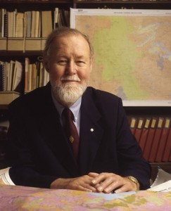
R.I.P. Roger Tomlinson
 Though I never met him, I was sad to learn yesterday of the passing of Roger Tomlinson a couple of weeks ago. Though I never met him, it’s safe to say that I would not have the job I have today were it not for him.
You’re probably asking yourself: “Why?”, to which my response is “Roger Tomlinson is the father of GIS“.
A Geographic Information System (GIS) is essentially a specialized database systems that allow you to store, analyze and visualize data geospatially. When many people think of GIS, they envision a digital map like Google Maps, but digital maps are mostly a product of GIS.
Personally, I have a degree in geography and I specialized in GIS and remote sensing. My honour’s project was a bio-climatic, bio-physical resource assessment of the Niagara peninsula with a view to growing grapes. Had I used pre-GIS techniques to conduct that analysis, I probably would have used dozens of large transparent sheets, each of which would have had one of the factors I considered (e.g. soil type, slope, aspect, elevation) that I would have stacked on a giant light table so I could pick out the various combinations that were associated with places you could grow grapes. It probably would have taken several hundreds of hours to create all the sheets by hand and then many more to do the actual analysis by hand. Instead, I was able to create layers for each factor in my GIS, including drawing on some digital soil maps from the provincial government, and then conduct the analysis to identify the unique combinations of conditions using tools in the GIS.
Since graduation, I have worked in a number of jobs along the way that have involved GIS, prior to landing in my current job where I am an analyst. Even today, though most of my analysis is performed using high-end statistical programs such as SAS, I still use a GIS to tease out the spatial relationships between in my data to see if people’s behaviours are tied to where they live as opposed to other factors, something that would be difficult to do without a GIS.
And as a contibutor to OpenStreetMap, I help to update and maintain an open source digital map of the world, which couldn’t exist without his ground-breaking work in the 1960s when he essentially created the Canada Geographic Information System for the government of Canada along with Lee Pratt, the data from which can still be found in GeoGratis today.
It’s probably safe the most Canadians’ lives are affected by his legacy, whether it’s the navigation apps on their smartphones, the GPS in their car, the natural gas heating their homes that was found by geologists using GIS, or the map on a real estate website they used to find a new home. Geographic information system technology is so pervasive and fundamental that without it the world we live in would be a very different place. And I almost certainly wouldn’t have the job I have today.
Rest in peace, Roger Tomlinson.


 AKA Keeper of Maps, I'm a geocacher who lives in Ottawa, Canada.

Thanks for sharing that Gord, I learned something new.
Thanks, Brian!