gordon.dewis.ca - Random musings from Gordon

Subscribe

Archive for August 18th, 2008

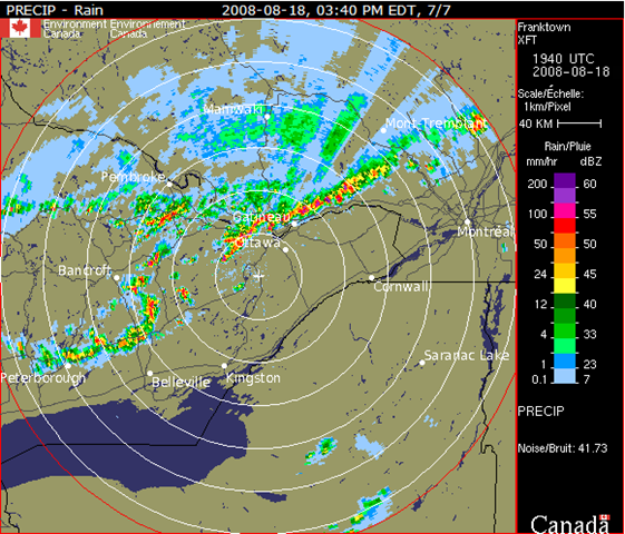
Exciting weather at the airport, too

August 18, 2008 @ 16:49 By: gordon Category: Current affairs, Weather

It appears that the weather has been exciting at the airport, too:

METAR CYOW 182000Z 22011G19KT 15SM SCT050CB SCT075 BKN230 27/19 A2969 RMK CB3AC1CI2 DIST LTNG SHS NW-NE SLP053=
SPECI CYOW 182003Z 31021G27KT 15SM TS FEW023 SCT045CB BKN075 BKN230 23/ RMK SC1CB3AC1CI1 OCNL LTGCG SHS NW-NE=
SPECI CYOW 182012Z 35023G32KT 12SM -TSRA FEW025 BKN045CB BKN075 BKN230 21/ RMK SC1CB4AC1CI1 OCNL LTGCG=
SPECI CYOW 182024Z 34023G29KT 1SM +TSRA BKN040CB BKN230 17/ RMK RA3CB3CI1 OCNL LTGCG CB OVHD=
SPECI CYOW 182024Z CCA 34023G29KT 1SM R07/4000VP6000FT R32/P6000FT +TSRA BKN040CB BKN230 17/ RMK RA3CB3CI1 OCNL LTGCG CB OVHD=
SPECI CYOW 182031Z 35011G16KT 3/4SM +TSRA BKN040CB BKN230 17/ RMK RA4CB2CI1 FQT LTGCG CB OVHD=
SPECI CYOW 182031Z CCA 35011G16KT 3/4SM R32/2800VP6000FT/D +TSRA BKN040CB BKN230 17/ RMK RA4CB2CI1 FQT LTGCG CB OVHD=
SPECI CYOW 182038Z 06009G16KT 4SM TSRA BKN040CB OVC140 17/ RMK CB5AC3 OCNL LTGCG CB MOVG SW VIS LWR S=

At one point, it looks like the wind was gusting up to 32 knots (59.2 km/h).

It’s stopped raining here, or at least let up enough that I won’t be soaked to the bone in three seconds with only my tired umbrella and my Tilley to keep me dry.

Exciting weather

August 18, 2008 @ 16:12 By: gordon Category: Current affairs, Weather

This popped up on my email a few minutes ago:

SEVERE THUNDERSTORM WARNING ISSUED For Ottawa BY ENVIRONMENT CANADA

BULLETIN ISSUED AT: 3:57 PM EDT MONDAY 18 AUGUST 2008
AT 3:40 PM THE RADAR IS INDICATING THAT A WEST TO EAST LINE OF SEVERE THUNDERSTORMS IS MOVING SOUTHEAST AT 80 KM/H. LARGE HAIL GREATER THAN 2 CENTIMETRES IN DIAMETER AND STRONG WINDS GUSTS OF 90 TO 120 KM/H ARE POSSIBLE WITH THESE STORMS. THERE IS ALSO A RISK OF A TORNADO.  THIS IS A WARNING THAT SEVERE THUNDERSTORMS ARE IMMINENT OR OCCURRING IN THESE REGIONS. REMEMBER SOME SEVERE THUNDERSTORMS PRODUCE TORNADOES..LISTEN FOR UPDATED WARNINGS. EMERGENCY MANAGEMENT ONTARIO RECOMMENDS TAKING COVER IMMEDIATELY WHEN THREATENING WEATHER APPROACHES.   SEVERE THUNDERSTORM WATCH FOR OTTAWA NORTH – KANATA – ORLEANS CONTINUED  SEVERE THUNDERSTORMS THIS AFTERNOON AND EVENING.  THIS IS AN ALERT TO THE POTENTIAL DEVELOPMENT OF SEVERE THUNDERSTORMS WITH LARGE HAIL AND DAMAGING WINDS.  MONITOR WEATHER CONDITIONS..LISTEN FOR UPDATED STATEMENTS. IF THREATENING WEATHER APPROACHES TAKE IMMEDIATE SAFETY PRECAUTIONS.


The Franktown radar at 15:40 Eastern showed:

image 

The view from my office window is very impressive.  I can see a sharp line along the edge of the clouds to the south.  A couple of minutes ago I watched as the bottom layer of clouds was swirling in a vertical manner while the layer above it was moving south.  And there’s thunder rumbling and we’ve seen a couple of flashes of lightning.

I wouldn’t be surprised if someone reports a funnel cloud because it sure looks like there might be a "comma" or two in the radar image.

Oh, and it’s just started to pour rain, to the extent that I can’t see the edge of the clouds any more.