


Eww
Environment Canada just issued this:
Issued at 2016-01-31 20:32 UTC by Environment Canada:
Special weather statement issued for:
Gatineau, Que. (031100)
City of Ottawa, Ont. (045400)
Current details:
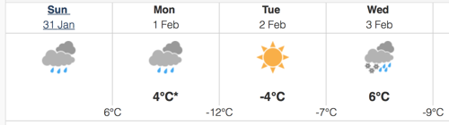
A winter storm is expected to develop over the United States central plains on Monday and track northeastward reaching the Great Lakes late Tuesday night. The storm is expected to bring periods of heavy snow over Central and Eastern Ontario Tuesday night before gradually transition to rain Wednesday morning. At this time, total snowfall amounts remain uncertain. The primary threat with this storm appears to be the risk of freezing rain and ice pellets which is expected to accompany the snow Tuesday night before transitioning over to rain especially over locations east of Georgian Bay to the Ottawa Valley. Gusty winds will accompany the approaching storm before gradually diminishing late Wednesday night as the storm moves out of the area and into Quebec.
From the sounds of it, it actually sounds like we’ll be ok compared to other parts of the province, but Wednesday could rate quite high on the suck-o-meter.
 AKA Keeper of Maps, I'm a geocacher who lives in Ottawa, Canada.
