Ottawa: -28C + 1 cup of boiling water + my balcony
It’s cold in Ottawa today:
So, I decided to throw a cup of boiling water off my balcony:
It’s cold in Ottawa today:
So, I decided to throw a cup of boiling water off my balcony:
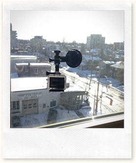 Rob posted a couple of time lapse videos on his Facebook timeline of the snow where he lives in the UK today, so I thought I’d see what I could make with my GoPro camera. The setup was pretty straight forward: I stuck the camera to my bedroom window and pointed it at the street below.
The GoPro Hero 3 Black offers a huge number of options for recording video, but it also can act as a still camera with conventional single-frame, burst mode (up to 30 frames in a 1 second burst) and a time lapse mode. It’s the latter that I chose, choosing a 30 second interval in 7 megapixel mode.
Once I had everything set up, I hit the trigger and left it running for about an hour and a half. After it was finished, I used Microsoft Live Movie Maker to combine all of the images into a single video, which you can see after the break.
I’m really not a morning person, and I’m ok with that. I like to travel, but I’m not a fan of really early flights. And based on the comments on some of the flights I was looking at yesterday, Air Canada knows this, too… 
It looks like we’re probably going to see some freezing rain beginning over the shortly before the lunch hour and continuing to mid-afternoon:
TAF CYOW 111438Z 1115/1212 09012KT P6SM BKN050 OVC140 TEMPO 1115/1116 P6SM -FZRA OVC050
FM111600 10012KT P6SM -FZRA SCT020 OVC050
FM112000 12010KT 4SM -RA BR BKN012 OVC025 PROB30 1120/1122 6SM -FZRA BR BKN025 OVC050
FM112200 13008KT 4SM -RA BR SCT007 OVC012 TEMPO 1204/1207 2SM -DZ BR BKN007 OVC012
FM120700 18007KT 2SM -DZ BR SCT003 OVC007
RMK NXT FCST BY 111800Z=
Hopefully, it won’t make the afternoon commute too treacherous.
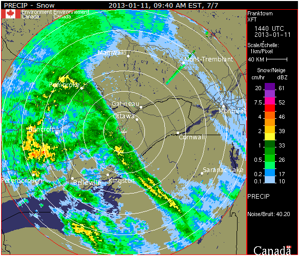
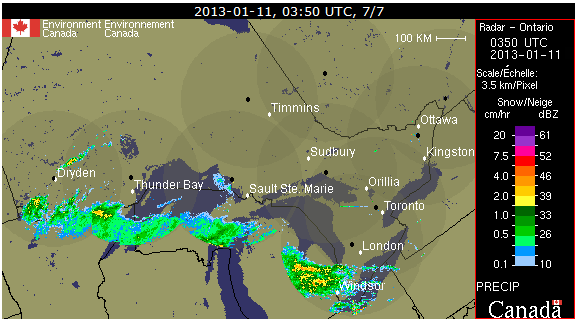
The incoming warm front I wrote about earlier can be seen on the edge of the composite radar image for Ontario:
So, I see from the Weather Office’s website that Ottawa is under a freezing rain warning for tomorrow afternoon. Judging by the TAF, it’s not going to arrive until noon, and even then it’s only showing as a 40% probability from noon until 1PM (the end of the forecast period).
TAF CYOW 101738Z 1018/1118 29012KT P6SM FEW040
BECMG 1020/1021 30005KT
FM110000 VRB03KT P6SM SKC
FM111200 09005KT P6SM OVC200
FM111700 10010KT P6SM -RA SCT020 OVC050 PROB40 1117/1118 6SM -FZRA BR BKN020 OVC050
RMK NXT FCST BY 102100Z=
 You can see the warm front passing through based on the wind directions in the various periods in the forecast. At the beginning, it’s out of the northwest at 5 knots, becomes variable at 3 knots at 0000Z (7PM) and then is out of the east at 5 knots early tomorrow morning. So, in about 12 hours it flips around almost 180 degrees. Fun.
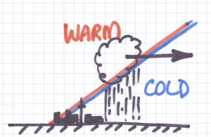
We’ll get freezing rain if the air being overrun by the incoming warm air is sufficiently cold enough to cause the rain drops condensing at the boundary between the warm and cold air to be supercooled so they freeze instantly on contact.
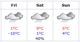 The next TAF should clarify how long the freezing rain is going to go on for tomorrow, but any way you slice it, it looks like my plans for snowshoeing on Saturday are probably going to be a bust, as you can surmise from the graphic.
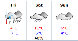 I have been looking forward to going snowshoeing this weekend with a bunch of friends for a while now, but having just looked at the long-range forecast for this weekend, I’m not at all confident that’s going to be possible.
As you can see from the graphic I clipped from the Weather Office’s website, there’s probably going to be freezing rain on Friday, which will put a crust on the snow. Then it’s supposed to go up to 11°C on Saturday, which is going to make the snow really sticky, and that sucks when you’re snowshoeing.
Nuts.
And this is going to set the canal back quite a bit, too.
Nuts again.