A closer look at geocaching and the Gatineau Park Ecosystem Conservation Plan
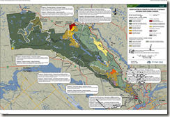
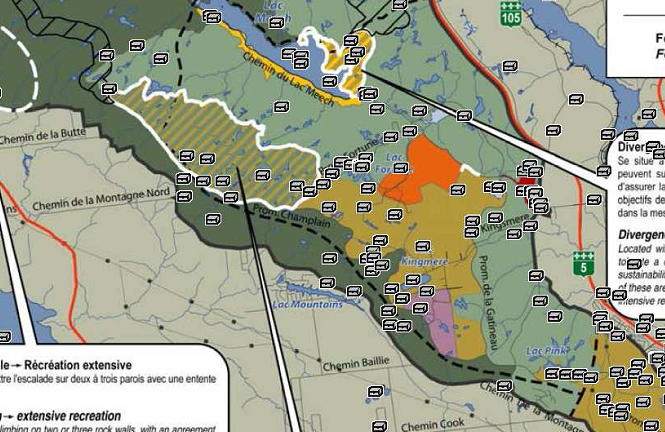
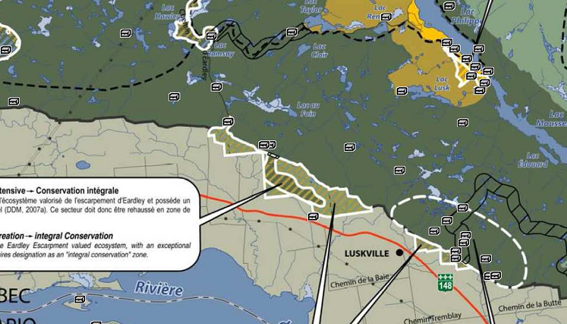
 John Goatcher, a local geocacher, sent me a map that overlays geocaches in and around Gatineau Park on top of the map found on page 39 of the Gatineau Park Ecosystem Conservation Plan (GPECP). As he commented in my earlier post on geocaching and the GPECP, it’s surprising that more geocaches aren’t in the “integral conservation zone” (the dark olive area in the maps), given that it covers roughly half of the total area of Gatineau Park. As you’ll recall from my previous post, geocaches in the ICZ “will be relocated in areas that are less sensitive before the end of summer 2010”.
About half of the potentially affected geocaches are in the southern part of the park, along the Eardley Escarpment and Champlain Parkway, which makes sense since this part of the park is more accessible to the general public.
Most of the other caches are further north where the network of parkways doesn’t extend. I don’t believe I’ve found any of the caches shown below so I’m not really sure how they’re accessed, but presumably it’s by the trail network, and possibly some bushwhacking.
Now, before the owners of geocaches in the ICZ start pulling their caches, they should probably check with the Gatineau Park conservation officers. It may turn out that their caches are in acceptable locations if they’re along the trails and similar locations.
A tip o’ the hat to John for preparing the map.


 AKA Keeper of Maps, I'm a geocacher who lives in Ottawa, Canada.

The caches along the Escarpment and off the Eardley Road are accessed by old trails maintained by the Ottawa Ramblers Club (I think that’s their name anyway). Commonly referred to as the ‘Yellow Dot’ trails after their distinctive markers there is an extensive network of ‘trails’ throughout that area. Some are obviously old roads, some are no more than faint footpaths, but all are ‘unofficial’ in that they are not maintained or marked in any way by the NCC.
It’s a shame to see some of these caches go, there are great trails and lovely country up there…
Blue –
I’m hoping that when the caches are reviewed by the NCC that some of them may be able to stay where they are, but it’s inevitable that some will have to be moved or archived.
The Gatineau Park Master Plan map (http://www.canadascapital.gc.ca/data/2/rec_docs/1772_Map1.pdf) suggested that large area’s of the Park would be designated C1, Integral Conservation. Geocaches in this area would naturally be removed, but areas designated C2, Conservation and Extensive Recreation, and R1 to R2, Extensive to Intensive Recreation suggested that recreational use would continue – but no geocaching?!
The policy makes no sense to me except in terms of the knee jerk reaction of an established bureaucracy banning anything that they didn’t think up on their own. The “Not Invented Here” syndrome.
My initial reaction was to rail against the faceless desk jockeys who can’t be bothered to learn about something before banning it, but then I remembered that there’s a million other geocaches out there and I’ll be too busy enjoying the hunt for them to worry too much about the NCC and their efforts to protect Gatineau Park from tupperware.
Blue –